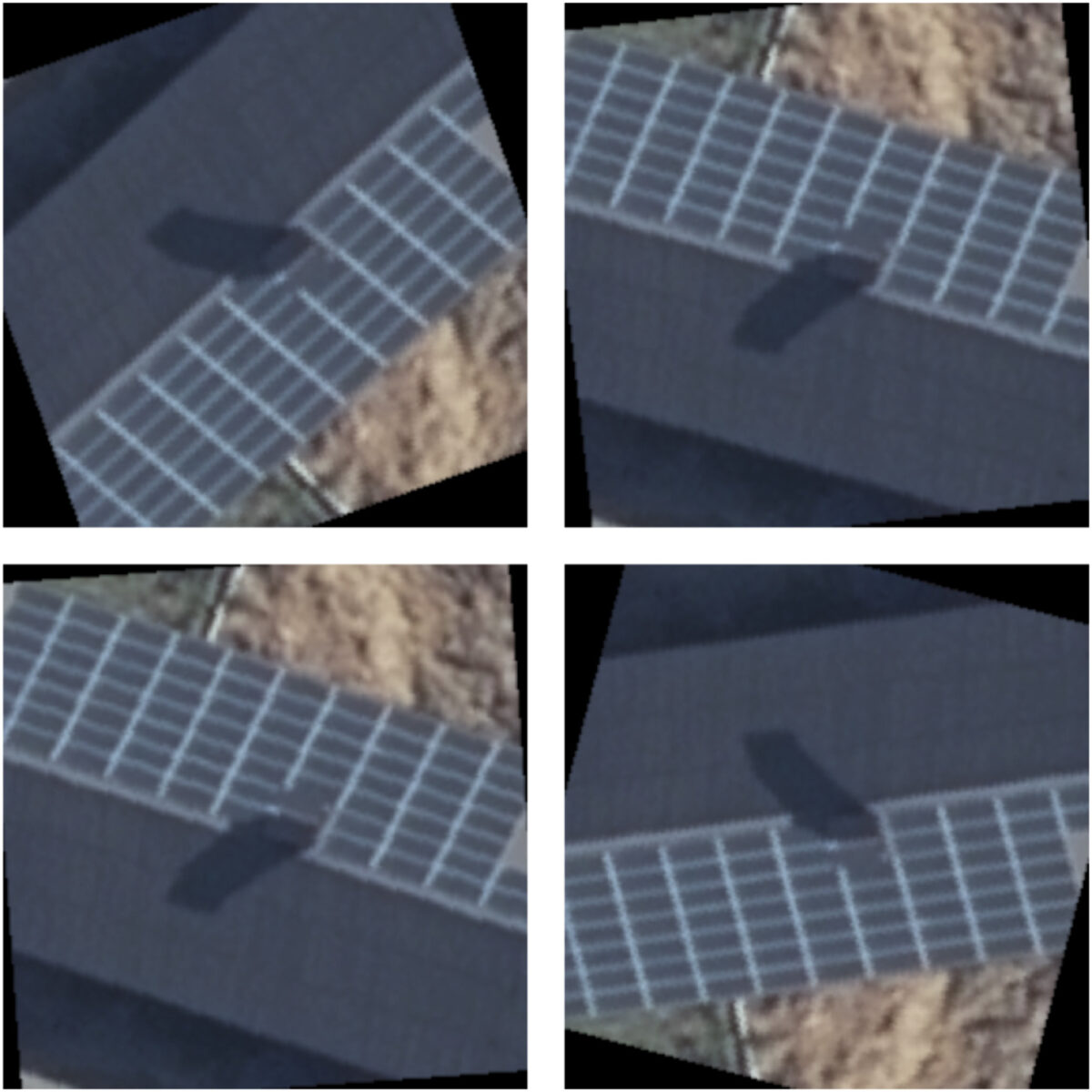
Swedish scientists have created a new automated model that they claim offers “superior performance” in identifying small, decentralised solar systems from aerial images. Such an automated system is said to be a useful tool to assist many stakeholders in the PV industry, as it can supply policymakers, authorities, and financial evaluators with accurate data.
The novel method utilises deep learning and image processing techniques to detect solar thermal and photovoltaic systems, and according to its authors, a follow-up study might even enhance the model to differentiate between the PV and solar thermal technologies.
“This is a challenging task as the two technologies share similar texture and colour appearance,” the article explains. “However, we believe that with the right modifications and improvements, it can be effectively adapted for multi-class segmentation of solar energy systems.”
In the study “Identifying small decentralised solar systems in aerial images using deep learning,” published in Solar Energy, the academics explained that they used a U-net architecture of convolutional neural networks (CNN), a convolutional network method for fast and precise segmentation of images, explaining that the key strength of this technique is that it requires a smaller number of input data and lower hardware usage compared to other approaches.
“The utilisation of the U-net model for solar energy systems detection provides a data-driven and automated solution with enhanced complexity, enabling precise detection,” they said. “Its accurate segmentation and identification of solar energy systems from aerial images hold substantial practical value, facilitating efficient assessment of panel performance, maintenance requirements, and energy production estimation.”
The new model was trained and tested on two databases – one from Germany and another one from Sweden – and a mixture of the two was used for higher generalization of its abilities. When compared to other CNN architectures, the researchers said the U-Net model stood out, especially in image segmentation tasks.
They also noted that the U-net model can be trained on aerial images with a resolution of 128 x 128 pixels, and achieve accuracy that is not significantly poorer than it does with a higher 256 x 256 pixel resolution. Its ability to use lower resolution, in turn, results in lower computer hardware usage.
“This study has proven that a U-net model can assess the area of solar energy systems in aerial imagery with high accuracy,” the authors said. “However, the tilt of the modules is also needed for a correct area estimation. Calculating the tilt can be done either from 3D building data or high/low-resolution LiDAR data. Combining the latter with the method of this study is the planned next step.”
This content is protected by copyright and may not be reused. If you want to cooperate with us and would like to reuse some of our content, please contact: editors@pv-magazine.com.



By submitting this form you agree to pv magazine using your data for the purposes of publishing your comment.
Your personal data will only be disclosed or otherwise transmitted to third parties for the purposes of spam filtering or if this is necessary for technical maintenance of the website. Any other transfer to third parties will not take place unless this is justified on the basis of applicable data protection regulations or if pv magazine is legally obliged to do so.
You may revoke this consent at any time with effect for the future, in which case your personal data will be deleted immediately. Otherwise, your data will be deleted if pv magazine has processed your request or the purpose of data storage is fulfilled.
Further information on data privacy can be found in our Data Protection Policy.