H2EX has turned to Fleet Space Technologies to help fast track its natural hydrogen ambitions after a gas soil sampling survey undertaken by the Commonwealth Scientific and Industrial Research Organisation (CSIRO), Australia’s chief science agency, revealed high-confidence hydrogen seeps in H2EX’s exploration licence in South Australia.
Naturally occurring hydrogen, known as ‘white’ or ‘gold’ hydrogen, is attracting increasing attention as a potential new renewable energy source with proponents confident the resource could be exploited at a lower cost than producing the gas from fossil fuels or electrolysis.
H2EX Chief Executive Officer Mark Hanna said the CSIRO’s latest report shows that the gas soil sampling field survey observed high-confidence hydrogen seeps in PEL 691, an exploration permit awarded to H2EX in June 2022.
The CSIRO and H2EX have completed two research agreements focused on the almost 6,000 square kilometre Eyre Peninsula site; a desktop study in December 2022 and a fieldwork survey conducted in April-May 2023.
Hanna said the work with CSIRO over the past year confirms that “where we theorised natural hydrogen is being generated subsurface correlates with high-confidence hydrogen seeps detected in the soil.”
“We now focus our attention to mapping the subsurface to identify commercial accumulations of natural hydrogen,” he said.

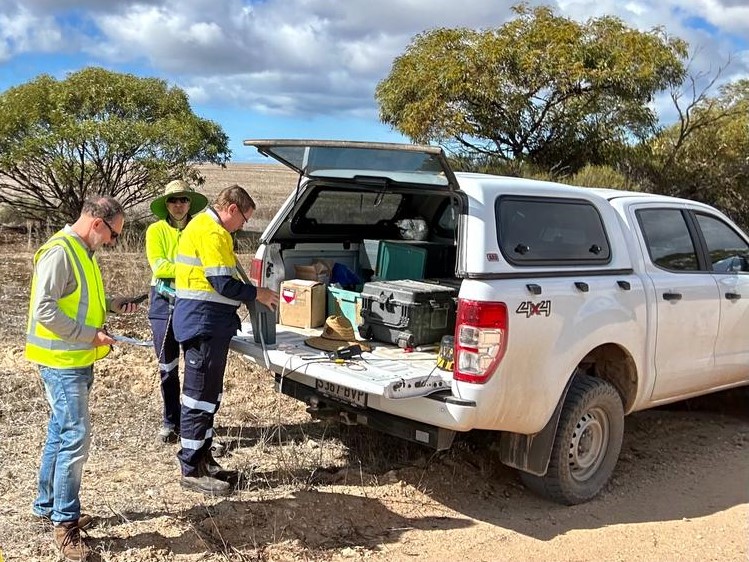
Image: Fleet Space Technologies
H2EX Chief Financial Officer Greschen Brecker said the company will now work with Fleet which will use its Exosphere scanning technology to explore prospective natural hydrogen zones identified by the CSIRO. The survey is expected to commence later this year.
Fleet said the Exosphere system is designed to help exploration customers reduce the time it takes to make a potential discovery.
Fleet said the Exosphere system delivers detailed subsurface 3D mapping using an array of geode sensors. The sensors create a detailed map of the subsurface using ambient noise tomography which listens to seismic waves present on Earth.
Fleet Chief Executive Flavia Tata Nardini said the data is then transmitted and processed via the company’s constellation of satellites in low Earth orbit to deliver a 3D visualisation of the area in near real-time, reducing the data acquisition process from six months to as little as a few days.
Brecker said the technology makes the exploration process faster, more sustainable, less expensive and more accurate.
“Fleet Space Technologies have the ability to considerably accelerate exploration, which is exactly what we need to deliver a clean energy revolution by 2030,” she said.
This content is protected by copyright and may not be reused. If you want to cooperate with us and would like to reuse some of our content, please contact: editors@pv-magazine.com.


1 comment
By submitting this form you agree to pv magazine using your data for the purposes of publishing your comment.
Your personal data will only be disclosed or otherwise transmitted to third parties for the purposes of spam filtering or if this is necessary for technical maintenance of the website. Any other transfer to third parties will not take place unless this is justified on the basis of applicable data protection regulations or if pv magazine is legally obliged to do so.
You may revoke this consent at any time with effect for the future, in which case your personal data will be deleted immediately. Otherwise, your data will be deleted if pv magazine has processed your request or the purpose of data storage is fulfilled.
Further information on data privacy can be found in our Data Protection Policy.