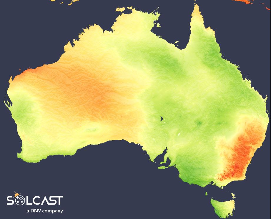
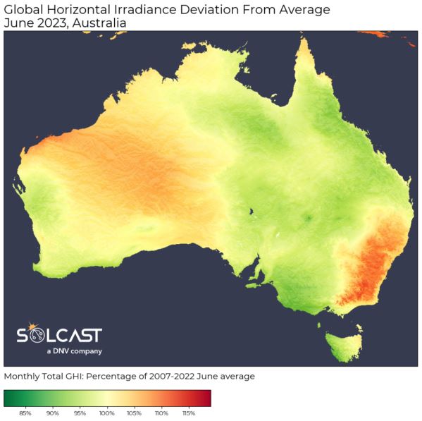
Eastern New South Wales (NSW) received irradiance about 15% above normal for June, while central and western Victoria received totals 10-20% lower than normal according to data collected by Solcast, a DNV company, via the Solcast API.
These variations were driven by unusually persistent low pressure in the Great Australian Bight. This system set up persistent westerly winds that dragged cold and moist air from the Southern Ocean into southeast Australia. However, the Great Dividing Range along the east coast of the continent forms a natural barrier, which dries out these westerlies, giving rise to broadly sunny conditions across eastern NSW – great for solar production.
Australia high rooftop solar penetration – with more than 17 GW of installed capacity across more than a quarter of households – are concentrated in the state capital cities, and so weather conditions in Melbourne and Sydney have an outsized impact on behind-the-meter generation.
Behind-the-meter rooftop solar totals from the Solcast API show that this weather pattern has continued into July.
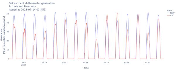
In Victoria, inconsistent and cloud-affected conditions are causing peak daily solar generation to drop to as low as 25% of nameplate capacity. In contrast, NSW is experiencing steadier solar performance, with peak daily generation consistently between 40-50% of nameplate capacity.
Solcast produces these figures by tracking clouds and aerosols at 1-2km resolution globally, using satellite data and proprietary AI/ML algorithms. This data is used to drive irradiance models, enabling Solcast to calculate irradiance at high resolution, with typical bias of less than 2%, and also cloud-tracking forecasts. This data is used by more than 300 companies managing over 150 GW of solar assets globally.
This content is protected by copyright and may not be reused. If you want to cooperate with us and would like to reuse some of our content, please contact: editors@pv-magazine.com.

By submitting this form you agree to pv magazine using your data for the purposes of publishing your comment.
Your personal data will only be disclosed or otherwise transmitted to third parties for the purposes of spam filtering or if this is necessary for technical maintenance of the website. Any other transfer to third parties will not take place unless this is justified on the basis of applicable data protection regulations or if pv magazine is legally obliged to do so.
You may revoke this consent at any time with effect for the future, in which case your personal data will be deleted immediately. Otherwise, your data will be deleted if pv magazine has processed your request or the purpose of data storage is fulfilled.
Further information on data privacy can be found in our Data Protection Policy.