“The thing that really impressed me is how far technology has advanced around PV performance and reliability monitoring,” Dr David Parlevliet, Murdoch University’s Deputy Head of Engineering and Energy, told pv magazine Australia when the in depth report he co-authored on behalf of the Australian PV Institute (APVI), reviewing portable onsite inspection methods for PV was released last week.
The report — Qualification of PV power plants using mobile test equipment — is published by the International Energy Agency’s PV Power Systems Task 13, and incorporates input from participating countries worldwide, with the aim of keeping the PV industry up to date with the latest technologies and best practice for optimising PV performance.
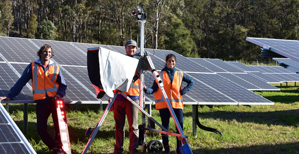
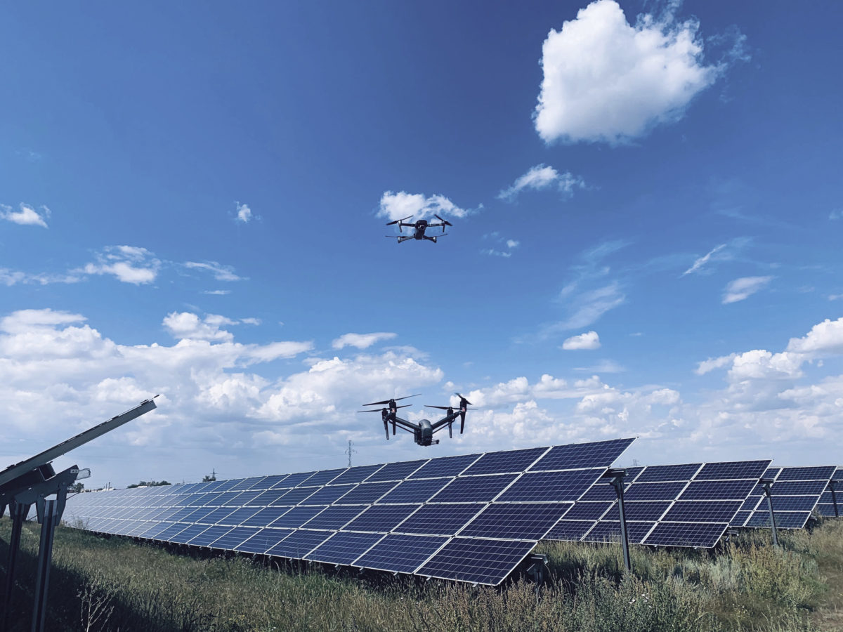
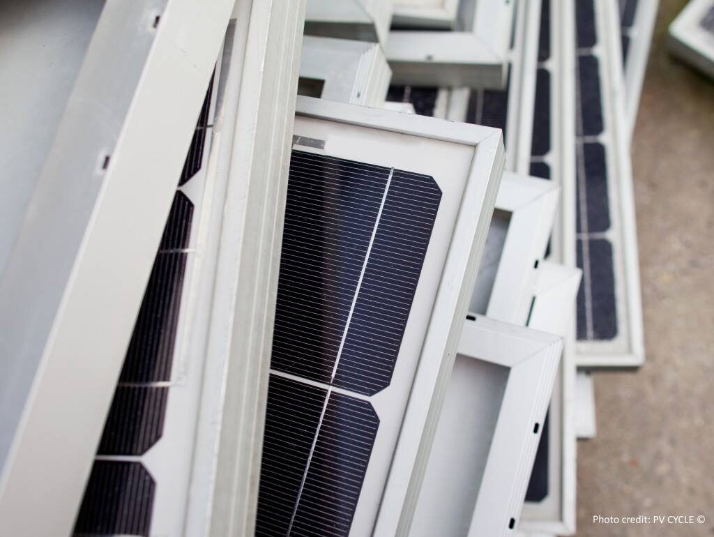
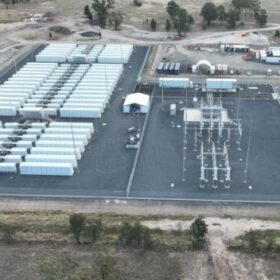
Image: APVI/UNSW
The value of large-scale PV installations relies on the modules performing to their anticipated yield, but the sheer scale of many PV plants today means 100% technical inspection is unfeasible.
“In Australia,” says a statement from the APVI, which partnered with international contributors on the report, “drones play an important part in identifying underperforming power plants.”
pv magazine Australia recently reported, for example on South Australian utility SA Water’s decision to contract UK aerial solar inspection and data analysis company, Above, to monitor the performance of its 370,000 solar panels deployed over 33 separate sites as part of utility’s Zero Cost Energy Future Initiative.
Rapid advances in infrared inspection using drones mean aerial surveillance now provides a clear overview of the operational status of installed PV arrays, as well as identifying specific PV strings or modules for further detailed analysis using mobile PV test centres, writes the APVI.
Importantly, says the report, the quality of such on-site inspection results is now comparable to insights gained in lab tests, and can reliably contribute to information required to implement repairs and substantiate warranty claims on faulty panels, without the need to ship them to offsite laboratories for assessment — which in turn poses the risk of damage to panels during transportation, and can result in lengthy downtimes of one or more PV strings.
Parlevliet is also Chief Remote Pilot at Murdoch, and brings deep experience of the capabilities of drones and the regulations governing their safe deployment, to his work on the paper.
Drones drop in cost, rise in capability
He says, “The drones themselves are significantly more advanced than they were even in relatively recent years.” In addition, they’ve become more commercially available, and the cost of the technology has fallen such that, “you can get an infrared equipped system from a common drone manufacturer for a few thousand dollars, which makes it a lot more accessible to small companies or users.”
But he says the greatest advances have been in two areas. First, the level of autonomy possible in drone capability — that is, drones are being programmed to fly a path according to a neural network “trained” using various orthophotos (aerial photographs that have been geometrically corrected so that the scale across the image is uniform and it can be used like a map) of PV plants; dynamic path planning by machine learning algorithms then optimises a surveillance path according to the capabilities of the drone and the particular nuances of each site.
The second area of advance is in machine learning as applied to processing and analysis of the vast amount of data gathered during surveillance using drone-mounted electroluminescence and thermal infrared imaging of utility-scale plants.
Existing aerial PV inspection systems developed by established innovators, such as Raptor Maps and Above, are lauded by the report, yet it says that their current “reliance on (semi-) manual image data processing” represents a drawback as “human error drives down the diagnostic accuracy of IR [infrared] imaging for PV”.
Scheduled autonomous inspection and analysis
Integrated autonomous monitoring and analysis are fast becoming a reality, as the abovementioned companies and researchers work to realised the potential for this technology.
Parlievliet’s colleague and a co-author on the report, Mohammadreza Aghaei, from Eindhoven University of Technology in the Netherlands, has designed and developed an autonomous monitoring system for large-scale PV plants which handles capture of imagery, automatic transfer of that data to a ground control station via RF channel, and secure relay of classified data by Google Cloud Storage to a database for processing. “After preprocessing and postprocessing of the aerial images and data, the entire processed information is transferred to the decision support system and O&M operator for future actions,” says the report. At this point, the autonomous system evaluates the information, identifying and analysing specific faults and failures, and their position in the solar farm, with a high degree of accuracy.
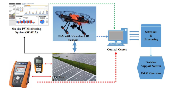
Image: International Energy Agency
The report gives equal weight to the review of other inspection methods — such as mobile PV test centres, plant-testing vehicles, “dark” and “daylight I-V testing, outdoor photoluminescence imaging and spectroscopic methods — in a similarly thorough manner.
Its analysis of each technology also clearly describes the types of failures it can detect, “Best-practice recommendations” and how to measure uncertainty aspects.
Drone-mounted imaging, for example, can detect cabling issues, combiner box issues, cell cracks, bypass diode failures, interruptions in the cell interconnection circuit and PID (potential induced degradation caused by high voltages) and LeTID (light and elevated temperature induced degradation).
Mobile PV test Centres, which are typically equipped with an integrated solar simulator, detect some of the same faults, but in tandem with the degradation those faults may cause in power outputs and resistive losses.
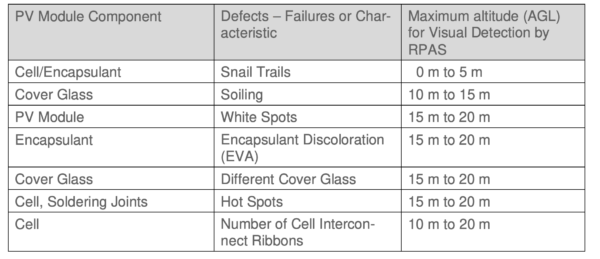
Image: International Energy Agency
Some of the most important best-practice procedures for drone-based monitoring says Parlevliet are to consider the proximity requirements for detecting defects of different module components, and consistently selecting good conditions for steady flight and clear, accurate image capture.
“The quality of images we get depends on the ambient conditions,” he tells pv magazine, adding, “You would usually try to monitor in dry, sunny, cloudless, low-wind conditions, to get the best data in the safest possible way.”
This content is protected by copyright and may not be reused. If you want to cooperate with us and would like to reuse some of our content, please contact: editors@pv-magazine.com.


By submitting this form you agree to pv magazine using your data for the purposes of publishing your comment.
Your personal data will only be disclosed or otherwise transmitted to third parties for the purposes of spam filtering or if this is necessary for technical maintenance of the website. Any other transfer to third parties will not take place unless this is justified on the basis of applicable data protection regulations or if pv magazine is legally obliged to do so.
You may revoke this consent at any time with effect for the future, in which case your personal data will be deleted immediately. Otherwise, your data will be deleted if pv magazine has processed your request or the purpose of data storage is fulfilled.
Further information on data privacy can be found in our Data Protection Policy.